by Anniek Schouten, COO & Co-founder of Overstory
Vegetation Management (VM) is a top priority for electric utilities. It is the single most important lever for mitigating risks of wildfires and power outages. Despite serious efforts and investment by utilities, reality shows critical information gaps still exist — with safety, environmental and financial risks as a result. A complete view on the current state and forecasted state of vegetation is critical for an effective workflow to mitigate these risks. The rise of satellite data and Artificial Intelligence (AI) brings the opportunity to close the loop with continuous data-driven vegetation management intelligence. Helping to improve the safety and reliability of the power line system and improving cost efficiency of operation and maintenance.
Challenge for society, economy and environment
Transmission and distribution networks often cross through forests and cities. When vegetation and power lines interfere it brings serious safety, economical, and environmental risks. Vegetation, in combination with severe weather conditions, is the most dominant cause of outages in electric power systems, resulting in millions of people without power and billions of dollars in economic damage. The combination of wires, vegetation and severe drought are at the source of record-breaking wildfires, endangering public safety and environment. With increasing frequency and duration of severe weather such as drought and storms, vegetation management is becoming ever more important. Inspections and forecasting of vegetation is key to allow effective mitigation of these complex risks. Determined to ensure a safe and reliable network of lines, utility vegetation management is on top of mind, agenda, and budget, for utilities’ transmission and distribution departments.
Vegetation and power lines: grow-in and fall-in risks
When managing vegetation, electric utilities take into account different vegetation encroachment risks on and around the rights-of-way (ROW). Two primary categories of encroachment that occur on and adjacent to power lines’ ROW are grow-in and fall-in:
- Grow-in refers to vegetation growing into a power line. How fast trees and their canopy grow is strongly dependent on tree species and climate conditions. Regulation often prescribes which vegetation species are allowed in proximity to power lines. Nonetheless, nature tends to go its own way. Fast-growing species may end up in or around the utility corridor, posing a grow-in risk.
- Fall-in refers to trees falling onto the power line. Fall-in can happen in severe weather conditions, such as instances of heavy winds. The risk of falling trees is amplified when trees are sick or soil conditions are weak.
Proper vegetation management includes understanding grow-in and fall-in risks for every mile. On ROW but also on the land adjacent to ROW. Identification and prioritization of high-risk areas help correctly plan and evaluate vegetation maintenance and look into where and when encroachments might occur in the coming month, season, and year.
What is missing from the equation?
Data is an integral part of all stages of the vegetation management process. This process starts with gathering and structuring available data. Understanding the state of the vegetation is step two and unveils the most important risk areas. With these maps in place companies can start to plan and execute vegetation maintenance. Continuously monitoring and reporting on the status and trends of these risks is not only key to confirm compliance but also to evaluate and adapt the current vegetation management strategy. This flywheel of vegetation management is complex, data-heavy, and often brings up various challenges to overcome.
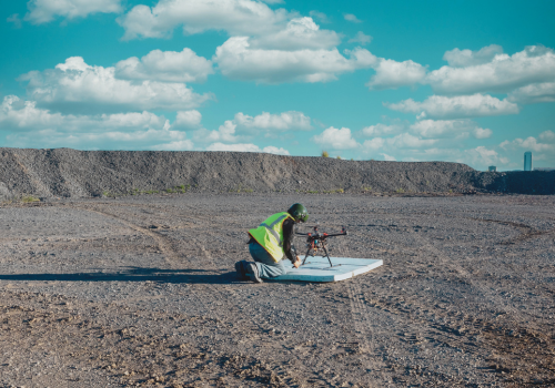
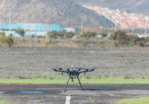
- Data structuring: Common data types gathered in line inspections include ground inspection data, aerial imagery and LiDAR — often captured via helicopters, airplanes, and drones. Structuring and pre-processing of these data sources is needed to combine the layers and leverage the data to its maximum extent. The current rise of satellite data is bringing major opportunities to enrich current sources. Newly launched satellites create high resolution images, combined with highly frequent updates. Scanning the entire grid is now possible up to a daily basis. Challenges often arise for utilities and grid operators at this stage: How do we structure these terabytes of data? How to combine the different sources in a cost-efficient way and to make optimal use of all the available data sources?
- Extracting vegetation intelligence and forecast: The second step is turning raw data into actionable intelligence. Machine learning specialized for earth observation allows to extract intelligence from the data at scale. Relevant characteristics include change of the canopy, tree species, tree height and tree vitality, and are a crucial input for the vegetation management process. Planning requires not only information on the current situation but also predictions and forecasting where and when vegetation may become a risk in the future. This is based upon tree species, fuel load, weather data and historical patterns and trends. For many companies, the question remains: How to turn raw data into actionable intelligence at scale? How do we utilize our data to the fullest extent?
- Prioritize & Plan: The vegetation intelligence map and forecast is then used to optimize and enhance planning of trimming and felling activities. Since the vegetation intelligence is regularly updated (up to each single day) it is used as input for optimized vegetation maintenance cycles. Optimized trimming cycles can have the objective of decreasing vegetation failure rates per mile per year and have a tremendous impact. Also, tree maintenance actions can be deployed more cost-efficiently. Which sections of the network require maintenance at what point in time? What are the priority locations? Needless to say, reliable and up to date vegetation intelligence will be key input for this.
- Manage & Report: A continuous feedback-loop about performed work and the status of encroachment is crucial. Monitoring and reporting is part of the vegetation management flywheel. The current and expected encroachments per mile, backlog of maintenance, vegetation failure rate per mile per month and geographical distribution of risk are examples of key performance indicators. Regular reporting does not only help to understand the status quo but also to pro-actively evaluate and improve management strategies in a data-driven manner.
Segmentation of tree canopy and tree height (in feet)
Filling the data gaps — By combining satellite data and AI
The world of vegetation management is evolving. Where helicopters and planes are widely used to inspect lines, the industry is still only scratching the surface of the potential of satellite data and Artificial Intelligence in vegetation management processes. The recent shift in quantity and quality of data comes with significant opportunities in downstream analytics.
- New view of the Earth: satellite data — Although satellites for remote sensing have been around for some time, the past years have a major shift occurred in the satellite industry. In recent years a record number of satellites have been launched by a growing number of commercial and non-commercial parties. Images are available with higher frequency, higher spectral resolution, precision, reliability, and sensor diversity. Optical and SAR satellites are launched by companies such as Planet, ICEYE, Capella Space, and Earth-i. This amount and diversity of satellite data is the fuel needed for Artificial Intelligence, allowing monitoring and on-demand quick scans.
- New ways to extract information: AI for Earth observation — The availability of satellite data is changing the world of machine learning (ML) and vice versa. Shifting from general out-of-the-box ML to specialized ML for Earth Observation. Data sets are complex and images consist of unstructured data. ML models, including Deep Learning for Earth Observation, make it possible to deal with the complexity of the data including clouds, angles, and shadows. By applying supervised and unsupervised machine learning techniques to complex data sets, it is possible to extract complex vegetation characteristics.
- Processing speed — Fast computers with massive processing power facilitate the processing of terabytes of data in a matter of seconds. Processing data in the cloud, close to the data, improves the speed and efficiency of processing.
This fast-growing technology comes with opportunities to rethink vegetation management for utilities. The combination of satellite data and artificial intelligence allows for frequent, up to date insight into the status of vegetation around the full power line network.
Vegetation Management Intelligence Platform (by Overstory)
Pinpointing risks by optimizing and combining data sources
Applying AI to satellite data facilitates to focus on the right areas. Where satellite data gives an up-to-date and cost-effective view on the different grow-in and fall-in risks, there is the opportunity to leverage and combine different data sources in an efficient way. Combining satellite data strategically with drone imagery, LiDAR, or even inspections and other ground data, allows for a complete view of vegetation risks throughout the entire network. Information about the quality, quantity, distribution and forecasted state of vegetation can be extracted from these data sources. This is crucial input for optimizing trimming cycles and reporting on the most important key performance indicators that drive reliability and safety of the grid. Vegetation management is a complex flywheel with a variety of challenges. Understanding and leveraging the available data allows companies to get grip on social, environmental and economical risks.
About Overstory
Overstory uses machine learning to the technology interpret satellite imagery and climate data in order to monitor the risk and impact of vegetation around transmission and distribution networks. The Overstory platform facilitates improved predictive planning of vegetation maintenance, verification of trimming activities, and reduces the costs of inspection of the distribution and transmission network.
Join thousands of industry peers who receive utility construction industry news and trends each week. Subscribe to The Utility Expo Newsletter.


