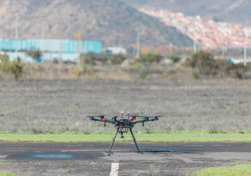
“The use of drones in the utility space is getting fairly advanced at this point,” says Vern Shurtz, Program Manager for the Trusted Operator Program at the Association for Uncrewed Vehicle Systems International. Needless to say, a lot of people are wondering how they themselves can begin using drones to help monitor, maintain and stabilize their utility infrastructure.
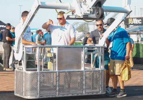
Shurtz, who happens to be a TOP Level 3 Remote Pilot and Remote Pilot Instructor, led a sold-out field classroom at The Utility Expo 2023. Attendees got a close-up look at some of the best drone technologies available today. They also viewed a live demonstration of how to safely use a drone to inspect a powerline. And they got to ask questions … a lot of questions.
Shurtz says the most frequent question he was asked was, “What kind of drone do I need?” He responded by explaining that it depends on what you’re looking to inspect and what types of data you’re looking to collect, which spawns even more questions. Shurtz offers his insights to those key questions below.
What can a drone be utilized for?
Drones in the utility industry are most commonly used to inspect powerlines, substations, towers and solar fields. That said, drones equipped with certain tools are now capable of completing other tasks such as accessing live lines to capture amperage readings, removing bird nests from different types of infrastructure, and even cutting damaged lines after a storm.
Pressure washing also holds a lot of potential. Pressure-washing drones are already being used to clean other elevated structures like multi-story buildings and water towers. Utility infrastructure like telecom towers and powerline poles seem to be a perfect fit.
“Most people don’t realize it, but bird droppings can be very detrimental to a lot of utility infrastructure,” Shurtz points out. While attending an event in Georgia, he watched a demonstration of a drone flying high into the air to spray a cleaning solution on powerline insulators, and then pressure wash it off. Shurtz says he was struck by how efficient the process was.
As the use of drones continues to grow, it’s expected that new tools will continue to be developed, further adding to a drone’s versatility and efficiency.
What equipment do I need?
As touched on earlier, this largely depends on what you’re looking to do with your drone. Let’s focus on infrastructure inspection for now.
At the base level, a drone equipped with an RGB camera will take high-resolution imagery. “The objective is to take photos from various angles,” Shurtz says. “Those photos can be presented to an inspector who looks for cracks or deformation so a crew can go out and make repairs before there’s a complete failure.”
As an extension of a basic RGB camera, Shurtz says a telephoto zoom camera is also popular because it allows the drone operator to focus in tight on whatever they’re wanting to inspect, even from further distances. “One thing to consider is the ratio of mechanical zoom to digital zoom,” Shurtz points out. If too much of the zooming is being done digitally, the image can start to pixelate and lose clarity. As a general rule, 1:1 is a good ratio to look for. For example, a telephoto camera with 25x mechanical (optical) zoom should be no more than 50x total zoom.
Another type of camera is a thermal camera, which looks for excessive heat through thermal imagery and/or the capturing of temperature readings. Shurtz says thermal cameras are a useful instrument for inspecting electric utilities and solar infrastructure because they can discover hotspots where different wires and components are failing.
One other useful piece of equipment is a LiDAR sensor. LiDAR is a more advanced means of data collection, but is also considerably more expensive. LiDAR is used to gather positional data. For example, a LiDAR-equipped drone could be used to determine how each tower in a series is positioned. Then a year later when another inspection is performed, updated LiDAR data would indicate if any of the towers have begun leaning in one direction or another, which could indicate foundation failure. Along those same lines, LiDAR can be useful when inspecting utility infrastructure after a severe weather event.
Some drones come pre-installed with the data collection instruments the user requests. But nowadays, it’s becoming more common to utilize a drone that allows different cameras and tools to be swapped on and off as needed. This approach helps boost a drone’s versatility and productivity, while also helping to contain cost.
What training do I need?
Just because you purchased a drone and a couple of cameras doesn’t mean you can run out and start inspecting powerlines and substations. A person must first obtain a Remote Pilot Certificate from the FAA. Additionally, Shurtz says it’s important to learn how to use the data-collection instruments correctly. Taking good photos will require some practice. Properly using a thermal camera takes practice, too, and may also require some additional education.
“The Infrared Training Center (ITC) has a course on small unmanned aerial system thermography,” Shurtz points out. “The course teaches you how to interpret different readings. Quantitative analysis relates to temperature information you’re collecting. Qualitative analysis relates to thermal images you’re interpreting. For example, you might see that a certain insulator is hotter than others. You could also see if that heat is spreading out across the wire in a gradient pattern, which suggests that an entire section has some level of degradation that needs to be dealt with. Understanding how to gather and interpret this type of data requires training, so obtaining a drone thermography certification is a good thing to do.”
How do I find work as a drone pilot?
Once a person has their Remote Pilot Certification and a good knowledgebase of how to use the data collection instruments, there is definitely a growing demand for their talents.
Shurtz says a skilled drone pilot can get hired directly by a utility company. A pilot could also operate as a subcontractor who offers their services to utility companies. Finally, a pilot could simply find work as a pilot with an existing subcontractor who already has a solid book of business in place.
“There is such a need for data collection that a utility company often can’t keep up on its own,” Shurtz says. “Utilities will often hire subcontractors to inspect certain sections of a large network. Those subcontractors will beef up their staffing for several months to complete a project. This can be a great way for a new drone pilot to cut their teeth and gain some experience. Then they can probably find a job with any utility around the country.”
That is because the use of drones to enhance utility maintenance and stability is becoming increasingly common, and those with the training and qualifications to use drones effectively are becoming increasing valuable.
About Vern Shurtz
Vern Shurtz is a TOP Level 3 Remote Pilot and Remote Pilot Instructor. In addition to his role at the AUVSI, Shurtz serves as an Adjunct Instructor at Embry-Riddle Aeronautical University.
Shurtz has been a commercial UAS (unmanned aircraft system) operator and remote pilot since 2015. His journey into the world of drones has been an interesting one. From 1982-1995 he was a nuclear propulsion plant mechanical operator in the U.S. Navy. “I essentially operated nuclear powerplants on submarines,” Shurtz says. “When you add up all the time, I spent about four years underwater.”
After Shurtz got out of the Navy, he spent the next several years developing multimedia training solutions, including augmented reality and virtual reality for industries including construction. He was spending a lot of time developing active shooter virtual reality training for schools when COVID-19 hit in 2020. Everything Shurtz was doing shut down.
“Something I had gotten pretty heavily into before that was flying drones, mainly for photogrammetry purposes,” Shurtz says. “So when COVID-19 hit, I started getting back into drones. I even took several courses at Embry-Riddle Aeronautical University, as well as courses from the AUVSI.”
Now Shurtz is a pilot instructor for both the AUVSI and Embry-Riddle.
Read Next
Top Tech Trends for Utilities in 2024
The Future of Drones in Utility Infrastructure Maintenance
Drone Powerline Inspection: What to Consider and How to Choose the Best Drone


